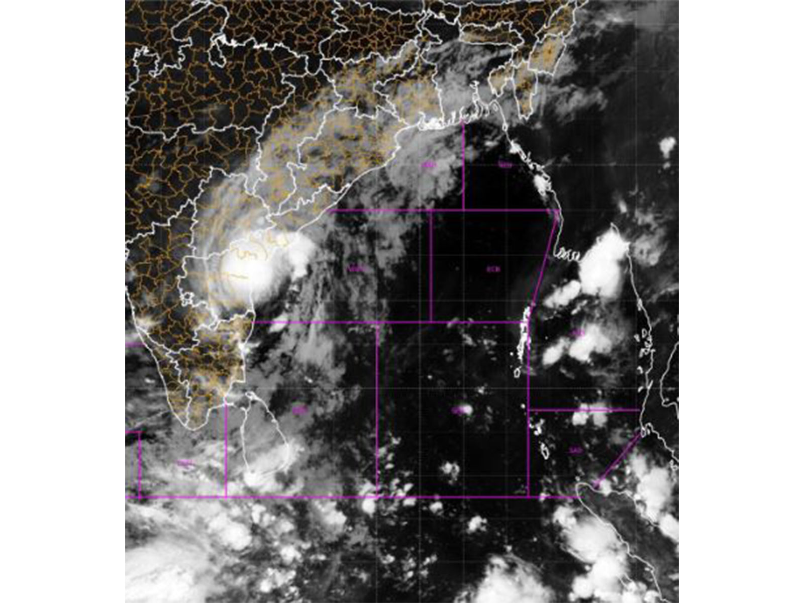
New Delhi [India], November 3 (ANI): Cyclone Murasu crossed Andhra Pradesh coast with a wind speed of 100 to 110 and rainfall expected at most places over central and north Andhra Pradesh with possibility of heavy to very heavy rainfall at a few places, said IMD Director General Dr. Mrutyunjay Mahapatra.
“The severe cyclone Murasu crossed Andhra Pradesh coast with a wind speed of 100 to 110, gusting to 120 kmph. It is expected to move slowly north-north-westwards during the next 12 hours. It may weaken into a cyclonic storm today afternoon, and into a deep depression by midnight of today. Thereafter, by tomorrow morning, it will become a depression over north coastal Andhra Pradesh and adjoining areas. So under its influence, the sea condition is still high to very high, that means there are waves of height of about 9 to 10 meters over the mid-sea…Highest rainfall of 22 centimeter has been reported in certain places. Today also we are expecting that there will be rainfall activity at most places over central and north Andhra Pradesh with possibility of heavy to very heavy rainfall at a few places and extremely heavy rainfall at isolated places…,” Mahapatra told ANI.

“Andhra Pradesh is most adversely affected with wind speed as I told you 100 to 110, 120 kmph. Also, there has been extremely heavy rainfall activity during the past 24 hours. The storm surge would have been about 1 to 1.5 meters at the time of landfall in the low-lying areas of Krishna, Bapatla, and Prakasam districts,” he further said.
Meanwhile, Amaravati Meteorological Department scientist S. Karuna Sagar said the process of severe cyclone Murasu crossing the coast in the coastal region is underway.
Speaking in Vijayawada, he said, “There is a possibility that the intensity of the cyclone will gradually decrease from tonight. Heavy rains are likely in Bapatla, Guntur, Krishna, Palnadu, NTR, Eluru and West Godavari districts.”
He appealed to people in cyclone-affected areas to remain alert and strictly follow the instructions of officials, adding that “moderate to heavy rainfall is expected at some places on November 4.”
Train services on the Vijayawada-Ongole-Gudur railway route were temporarily suspended in view of cyclone conditions, said Vijayawada Division PRO Nusrat M. Mandrupkar.
“A total of 29 trains have been affected by the cyclone, with 19 UP and 10 DOWN trains under regulation. Passengers are advised to check the latest train information before starting their journey through official railway platforms like IRCTC, RailOne, NTES or by calling Railway Enquiry No. 139,” Mandrupkar said.
India Meteorological Department (IMD) said the “cyclonic storm is very likely to continue to move north-northwestwards and weaken into a deep depression (wind speed reaching 55-65 kmph gusting to 75 kmph) by 1800 UTC of today, the 3rd November, 2026.”
It is under the continuous surveillance of Doppler Weather Radars at Machilipatnam and Visakhapatnam, it further said. (ANI)
Related reading